

When exploring a new city, hiking a remote mountain trail, or traveling abroad without cellular roaming, having access to reliable information about your surroundings makes all the difference. CoMaps is a community-driven, open-source mobile navigation application that provides privacy-focused navigation for iOS, Android, Mac, and Linux. Instead of relying on a single closed database, CoMaps combines multiple open-data initiatives, including OpenStreetMap (OSM) for geographic features, Panoramax for street-level imagery, and Wikimedia project data for contextual knowledge.
CoMaps is also built to be "offline first." Users begin by downloading map packages for the region they're interested in. This allows them to navigate, search for points of interest, and read Wikipedia articles without an active internet connection. While there is some online-only functionality like viewing imagery from Wikipedia or Panoramax, the app attempts to do as much as possible without further network connectivity.
Connecting Open Maps to Human Knowledge
CoMaps is built as a general-purpose map based on OpenStreetMap data. While Wikipedia is both a database for storing knowledge as well as a user-facing encyclopedia for people to consume that knowledge, OpenStreetMap focuses on fulfilling only the first task: being a database of geospatial information. Other organizations, both open-source and commercial, use OpenStreetMap data to build their own products and applications. CoMaps is one of those open-source projects creating an interface for everyone to interact with maps in the way they want, focused on providing that data for offline navigation, as well as bridging OSM data with knowledge from the rest of the open knowledge ecosystem.

Photo by Anton from CoMaps, CC BY 4.0
Within OpenStreetMap, community mappers can tag places and landmarks with their corresponding articles in Wikipedia, or corresponding Wikidata identifiers (QIDs). These tags allow CoMaps to pull in contextual data such as photographs, historical info, and encyclopedic knowledge. CoMaps uses the tags linking Points of Interest from OpenStreetMap to corresponding knowledge from Wikidata, Wikimedia Commons, and Wikipedia. In this way, CoMaps leverages the hard work put in by both the OpenStreetMap and the Wikimedia volunteer communities.
This means that when someone has loaded CoMaps on their phone for offline use, they automatically get offline access to knowledge about their surroundings, pulled from Wikipedia and Wikidata. When a user taps a landmark, historic building, or mountain peak in CoMaps, the app surfaces the corresponding Wikipedia article directly on their screen. Whether a hiker wants to learn about the geological history of the valley they're walking through, or a traveler wants to read about the history of the cathedral they're standing in front of, the information is available instantly without the need for cellular data.
Scaling Multilingual Data Ingestion with the Wikimedia Enterprise Snapshot API
CoMaps is expanding its language support to serve a global community, which poses a major challenge in processing and maintaining Wikipedia data at scale. Downloading and parsing raw wiki dumps across dozens of language editions required a significant increase in the consumption of Wikipedia data. CoMaps switched to using Wikimedia Enterprise endpoints after the experimental public HTML dumps were phased out.
Once a month, CoMaps ingests Wikipedia project snapshots across supported language editions using the Wikimedia Enterprise Snapshot API. The Enterprise infrastructure can easily handle the increased data consumption CoMaps requires, providing stable, reliable endpoints on a regular update cadence.
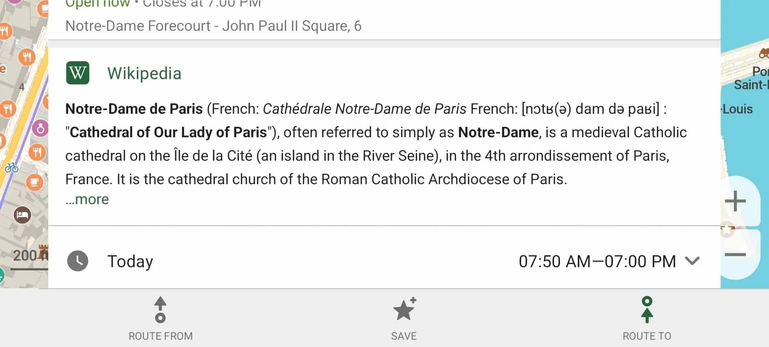
Screenshot by CoMaps contributor, CC BY 4.0
When CoMaps first started using Wikimedia Enterprise, free accounts allowed up to 15 Snapshot downloads a month, which wasn't enough to cover CoMaps' use case. They were one of the first to apply for exceptional access, to get a higher allowance of monthly snapshot downloads. After review by the Commercial Partnerships Division and Wikimedia Deutschland, in accordance with the exceptional access policy, Wikimedia Enterprise instead expanded free account limits for everyone: free accounts now get up to 30 free snapshot downloads a month. This covers CoMaps' use case, and it will surely cover many more use cases in the future. The exceptional access process is made for organizations like CoMaps: they're a fully volunteer-run, non-profit project that aligns with Wikimedia's mission and values. CoMaps' use of the Wikimedia Enterprise free account limits strikes the perfect balance between being able to benefit from production-grade reliability and throughput without imposing financial strain or infrastructure overhead on the team.
Streamlining Parsing and Fostering Community Contributions
As CoMaps continues to evolve, the team is exploring new ways to deepen its integration with the Wikimedia ecosystem. It's following the Structured Contents initiative with great interest, and is weighing the options of how it could improve its sanitization of article bodies across language editions in the future.
"We love that the Wikimedia Enterprise team is handling article parsing; this way, we can continue to rely on high-quality machine-readable access to articles."
- Will from CoMaps
Currently, CoMaps uses custom parsing scripts to extract and sanitize article bodies across language editions. Because wikitext formatting and infobox templates vary between languages, onboarding new language editions requires some manual maintenance. Transitioning to Structured Contents could allow CoMaps to ingest pre-parsed JSON payloads directly, removing parsing friction and accelerating support for new languages. With CoMaps already having migrated to using the Wikimedia Enterprise APIs, it's become easier to start consuming Structured Contents too.
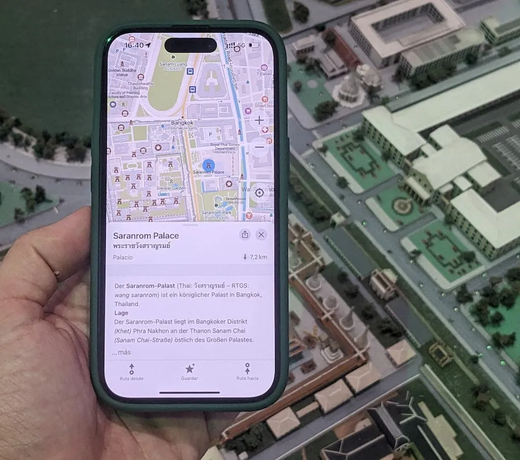
Photo by Anton from CoMaps, CC BY 4.0
Both OpenStreetMap and Wikipedia rely on volunteer communities. CoMaps already includes built-in editing features for OpenStreetMap, and the team is interested in encouraging users who discover missing or outdated information to also contribute back to Wikipedia, Wikidata, and Wikimedia Commons. Creating a seamless pathway from offline reading to active community editing helps ensure the long-term health of the open-knowledge ecosystem.
Like so many open-source projects, the main bottleneck in working on these new features is finding contributors who can spend the time and effort to implement them. If you want to become part of the CoMaps community and help improve its connection to Wikimedia projects, you can contribute to the open-source repository on Codeberg.
About CoMaps
CoMaps is a community-driven map app project born out of the desire to create a truly open, transparent, and community-focused navigation app. CoMaps' goal is to provide easy, offline navigation for travelers, drivers, hikers, and cyclists, all while respecting user privacy and supporting open-source collaboration.
- Wikimedia Enterprise Team
Photo Credits
Mount Bradley in Matanuska-Susitna Borough, Alaska, CC BY 2.0
